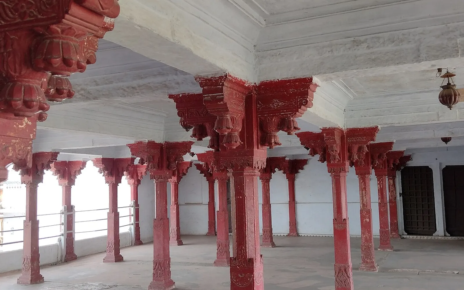
History and people
Hadoti Region of Rajasthan: History, Districts and Culture
Written by Kota Rajasthan Editorial Team · Updated
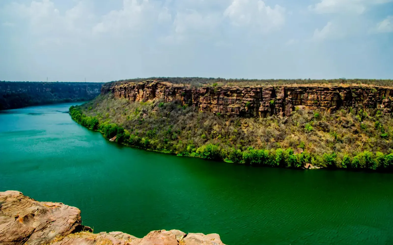
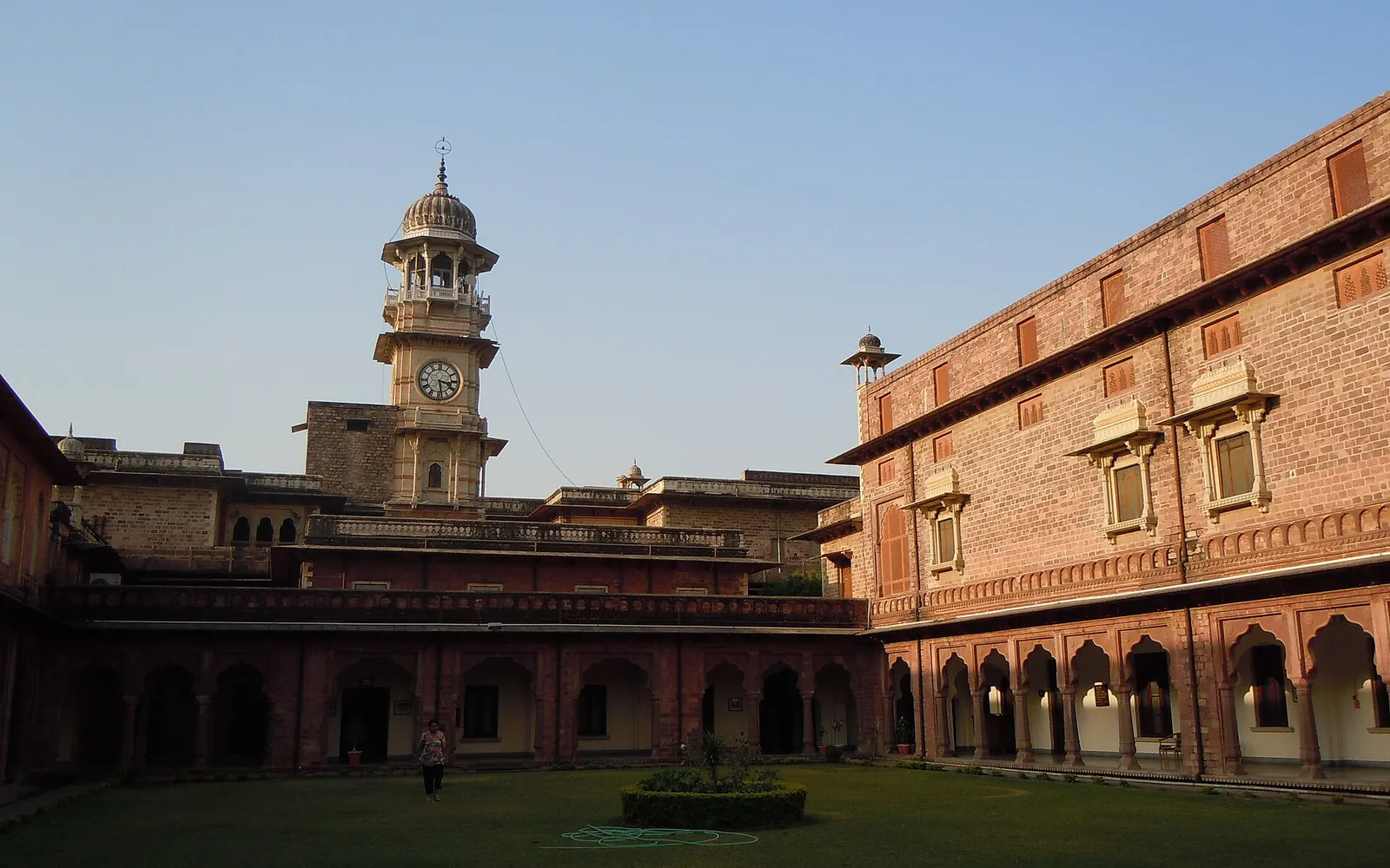
The Hadoti region is the southeastern corner of Rajasthan: the four districts of Kota, Bundi, Baran and Jhalawar, strung along the Chambal and its tributaries where the dry Rajasthani plains give way to the wooded edge of the Malwa plateau. If you have been reading about Kota on this site, you have already been reading about Hadoti. This page steps back and explains what the region is, where its name comes from, how its history fits together and how to explore it.
What is Hadoti?
Hadoti (also spelled Harauti, Hadauti or Haravati) is a historical and cultural region rather than an administrative unit, although today its four districts together make up the Kota division of Rajasthan. It is bounded by the Malwa plateau to the east and south, with Madhya Pradesh across the border, and by the Aravalli hills and Mewar to the west.
Compared with the deserts of western Rajasthan, Hadoti is green and well watered. The Chambal River cuts through it from south to north, joined by the Kali Sindh, Parvati, Parwan and other rivers. That water explains a great deal about the region: the dams and barrages of the Chambal valley project, the fertile alluvial farmland, the forests of the Mukundara Hills, and the many water forts and lakeside palaces.
Where the name comes from
The region is named after the Hada (or Hara) Rajputs, a branch of the Chauhan clan. According to the standard histories, Rao Deva (also written Rao Devda) took Bundi in 1241 CE (some accounts say 1242), and the Hadas went on to rule the surrounding country, which came to be called Haravati or Haroti, the land of the Hadas. Rajasthan Tourism’s Kota page puts Rao Deva’s conquest a little earlier and says he “founded Hadoti”; the exact year varies between sources, but all agree that Bundi was the first Hada capital.
Kota itself remained part of the Bundi kingdom for almost four centuries. The site’s own history of Kota covers the details: in 1631 (some sources give 1624) the Mughal emperor granted Kota as a separate state to Rao Madho Singh, a younger son of Rao Ratan Singh of Bundi. From then on Hadoti had two Hada kingdoms, Bundi and Kota, ruled by related branches of the same family.
Four districts, three historic states
The modern district map overlays an older pattern of princely states:
- Kota was the larger of the two Hada states and the seat of the Maharaos, with the Garh Palace on the Chambal as its centre.
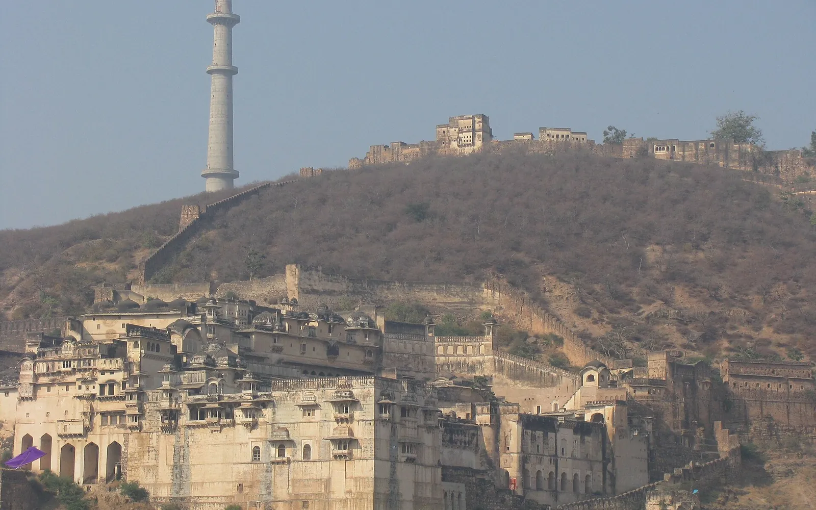
- Bundi remained the senior Hada house, with its hillside palace and Taragarh Fort. Its last ruler acceded to the Indian Union in 1949.
- Jhalawar was created in 1838 out of part of Kota’s territory for the descendants of the regent Zalim Singh Jhala. Its rulers were Jhala Rajputs, not Hadas, but the state sits squarely in Hadoti.
- Baran was mostly part of Kota state before independence. It became a separate district only on 10 April 1991, carved out of Kota district.
After independence the princely states were merged in stages into Rajasthan. Kota joined the Rajasthan Union in March 1948, and the four districts are today administered from Kota as a division.
Older layers of history
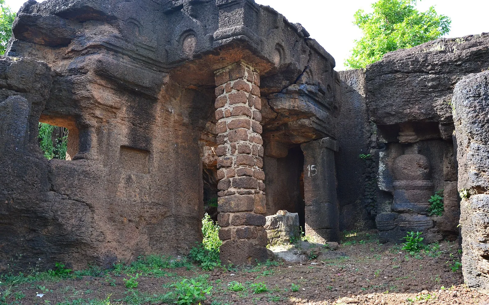
The Hada period is only the most recent chapter. Hadoti contains rock paintings at sites such as Alnia and Darrah that point to very early human presence; the Alnia Dam rock paintings are the easiest to visit from Kota. The Kansua temple in Kota has an inscription dated 738 CE. The temple groups at Baroli, Jhalrapatan and Kakuni, and the Buddhist rock-cut caves at Kolvi in Jhalawar district, all predate the Hada kingdoms by centuries. Further south, Gagron Fort was a stronghold of the Khichi Chauhans before it changed hands among the sultans of Malwa, Sher Shah and the Mughals.
Language: Harauti
The region has its own language, Harauti (Hadauti), one of the Rajasthani languages of the Indo-Aryan family, written in Devanagari. Linguists place it in the central-eastern Rajasthani group. Grierson’s Linguistic Survey of India recorded it in Kota, Baran, Bundi and Jhalawar and neighbouring parts of Madhya Pradesh, and recent estimates put the number of speakers at around four million.
In practice you will hear Hindi in Kota city, where students and migrants from all over India have changed the linguistic mix, and Harauti in the villages and market towns. In the 2011 census about 70 percent of people in Baran district gave Harauti as their first language. In Jhalawar the picture is more mixed: Hindi, Harauti, Malvi and Sondwari are all widely spoken.
Culture: what makes Hadoti different
A few things set Hadoti apart from better-known parts of Rajasthan:
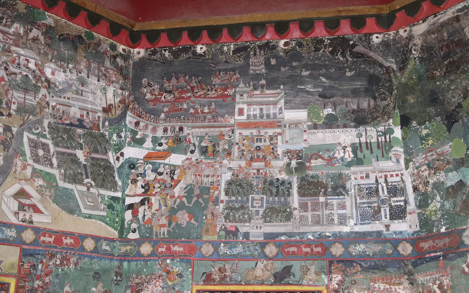
- Painting. The Bundi and Kota schools of miniature painting are among the most admired in Rajasthan, famous for Bundi’s lyrical palace murals and Kota’s hunting scenes. See our guide to the Kota school of painting.
- Krishna devotion. Kota’s rulers were patrons of the Pushtimarg tradition, and temples such as Mathuradheesh remain important pilgrimage sites.
- Crafts. The fine, chequered Kota Doria cloth of Kaithoon and the grey-green Kota stone of the Ramganjmandi quarries are both Hadoti products.
- Fairs. The Kota Dussehra Mela, the Chandrabhaga fair at Jhalrapatan, Bundi’s Kajli Teej and the Sitabari fair in Baran each draw large crowds. Our festivals calendar lists them month by month.
- Food. Kota is known for kachori; Bundi Utsav stall menus feature regional dishes such as katt bafla and gatte ki sabzi.
How to explore Hadoti
Kota is the practical base. It is a major junction on the Delhi-Mumbai rail line and is linked by highways to Jaipur, Bundi, Jhalawar and Baran. Rajasthan Tourism gives road distances from Kota of roughly 36 km to Bundi, 74 km to Baran and 88 km to Jhalawar. See how to reach Kota for transport details.
A sensible plan for a first visit:
- Spend a day or two in Kota itself: the Garh Palace, Kishore Sagar and Jagmandir, and the Chambal. The one-day Kota itinerary covers the essentials.
- Take a day, or better an overnight, in Bundi. Our weekend in Bundi guide has a route.
- Go south to Jhalawar for Gagron, the Sun Temple and the Chandrabhaga temples: see Jhalawar tourist places.
- Go east to Baran for the Ramgarh crater and Bhand Devra temple, Shergarh and Sitabari: see Baran tourist places.
The best time to visit is October to March. The monsoon months make the gorges and waterfalls spectacular but can close river trips and some rural roads.
Where to go next
If you want the deeper story, read the history of Kota and the profiles of the people who shaped the city. If you are planning a trip, start with the places guide and the itineraries.
Frequently asked questions
Which districts are in the Hadoti region?
Hadoti is usually defined as the four districts of Kota, Bundi, Baran and Jhalawar in southeastern Rajasthan. Together they form the Kota division of the state.
Why is the region called Hadoti?
The name comes from the Hada (Hara) Rajputs, a branch of the Chauhan clan who ruled Bundi from the 13th century and Kota from the 17th. Hadoti, or Haravati, means the land of the Hadas.
What language is spoken in Hadoti?
Harauti (also written Hadauti or Hadoti), a Rajasthani language, is the main home language in the countryside. Hindi is widely used, especially in Kota city, and Malvi is spoken in parts of Jhalawar.
What is the best base for exploring Hadoti?
Kota has the best rail and road connections and sits roughly in the middle, so most travellers base themselves there and make day trips to Bundi, Jhalawar and Baran.
Sources
Editorial team
The KotaRajasthan.net team writes about the places, history and festivals of Kota and Hadoti, and corrects pages when readers point out changes.