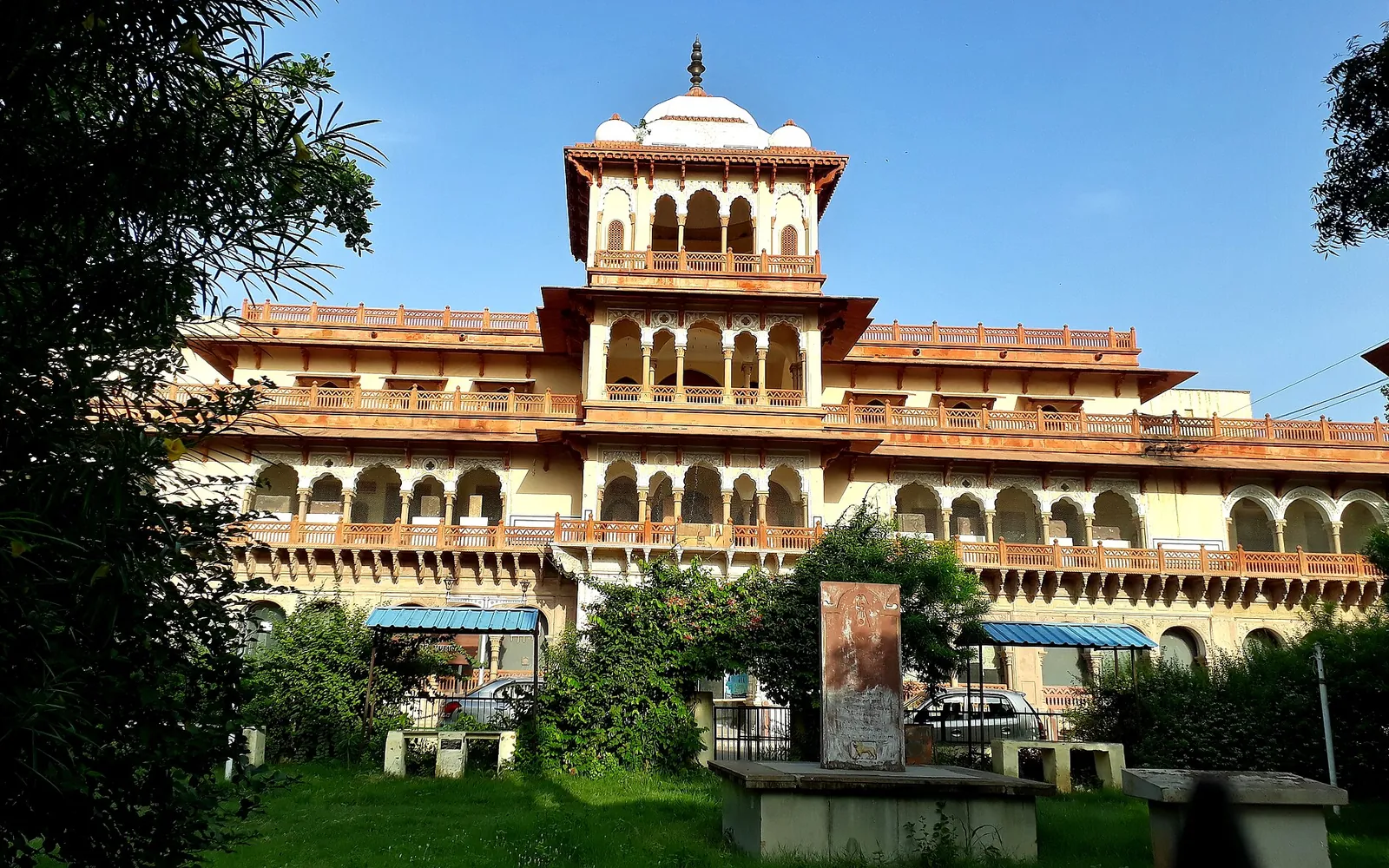
Hadoti day trips
Rawatbhata Tourist Places: Baroli, Dams, Forts and Falls
Written by Kota Rajasthan Editorial Team · Updated
The best Rawatbhata tourist places are a short drive from Kota but feel a world away from the city: a group of 10th-century temples at Baroli, the great Rana Pratap Sagar dam on the Chambal, the water-carved gorge of Chuliya Falls and the fort of Bhainsrorgarh above two rivers. Rawatbhata itself is a planned township built around the Rajasthan Atomic Power Station, so most people know it for nuclear power rather than heritage. This guide covers what is worth seeing, how to fit it into a day from Kota and what to keep in mind near the power station.
Rawatbhata at a glance
Rawatbhata is a town and tehsil headquarters in Chittorgarh district, on the Chambal river south-west of Kota. Wikipedia puts it about 50 km from Kota and 131 km from Chittorgarh city, its own district headquarters. By road from central Kota it is roughly 55 to 60 km.
Two big projects shaped the town in the 1960s. The Rana Pratap Sagar dam, the second stage of the Chambal Valley Project, was built here, and in 1963 work began on the Rajasthan Atomic Power Station with Canadian help. The townships of Vikram Nagar and the Anu colonies grew up around them. That history is why Rawatbhata is often called the nuclear city of Rajasthan.
The best places to visit around Rawatbhata
Baroli temples
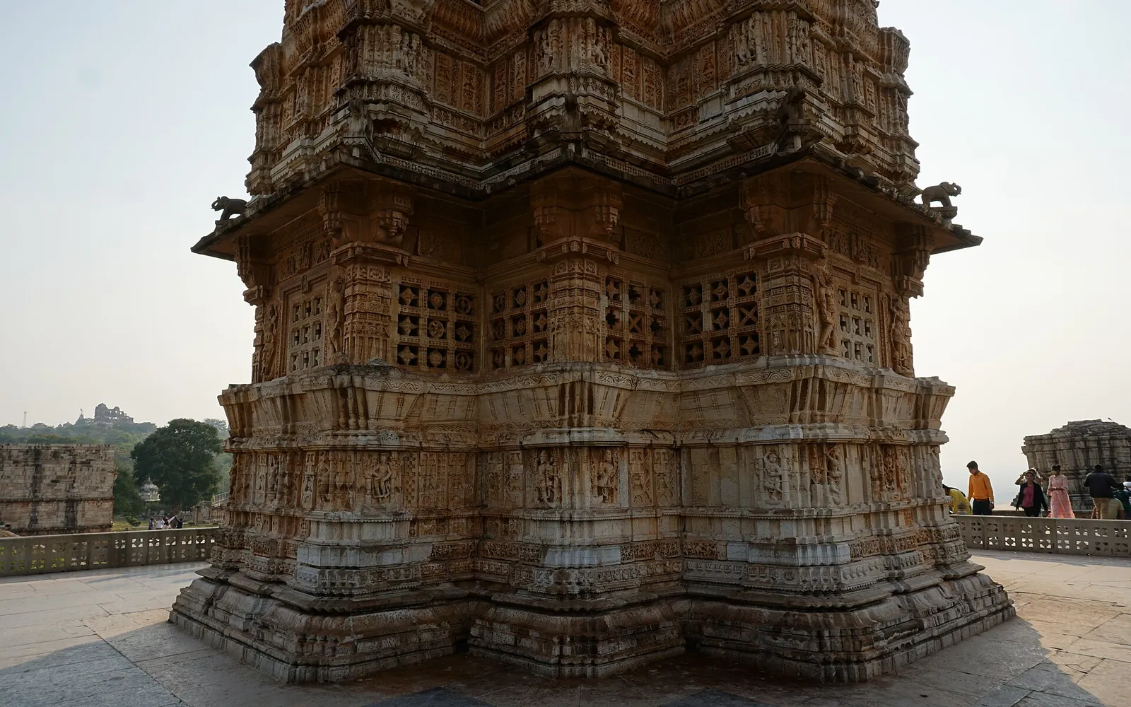
The highlight for most visitors. Baroli is a group of temples in a walled enclosure, with one more about 1 km away, built in the 10th century in the Gurjara-Pratihara style and protected by the Archaeological Survey of India. The Ghateshwar Mahadev temple has some of the finest carving in Hadoti, and the site is usually quiet. Read our full guide to the Baroli temples and the background in Hadoti temple architecture.
Rana Pratap Sagar dam
A 53.8 m high masonry dam that opened in 1970, with a hydroelectric station of 172 MW. Wikipedia describes it as the biggest dam in Rajasthan, and it also supplies water to the atomic power station. A road crosses near the dam to Vikram Nagar on a small hill, where a large statue of Maharana Pratap overlooks the town. See Rana Pratap Sagar dam.
Chuliya Falls
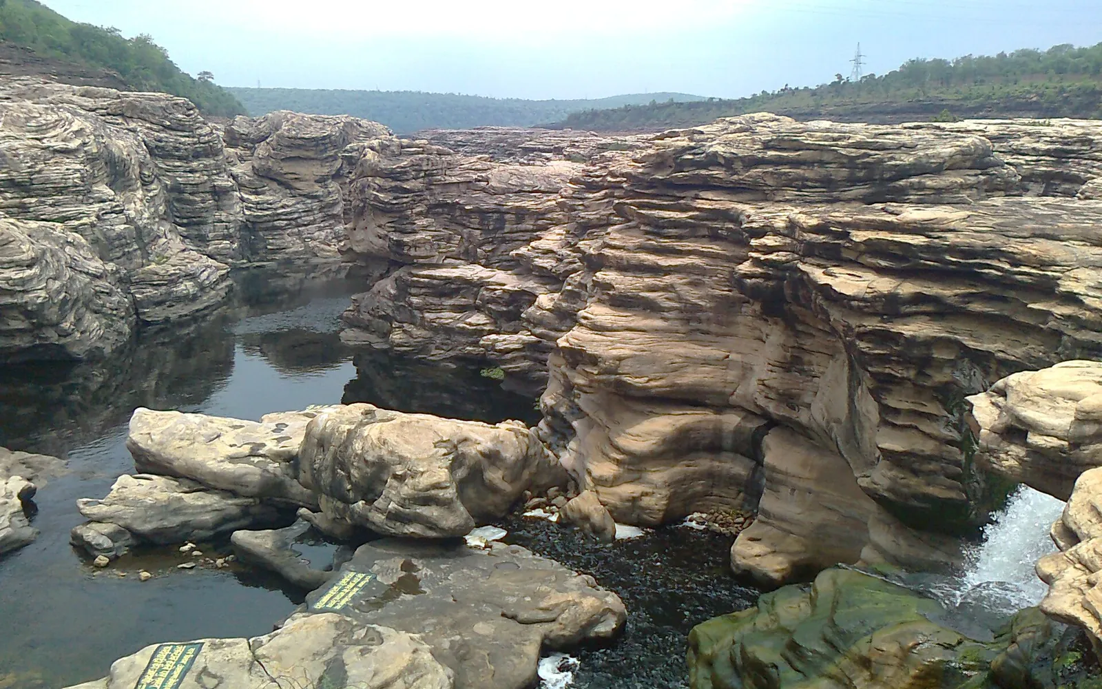
About 1.6 km below the dam, the Chambal drops through a gorge of layered rock carved into channels, potholes and ledges. In the dry season you can see the rock forms clearly; in the monsoon, when the dam releases water, it becomes a roaring torrent. Because flow is controlled by the dam, water can rise quickly, so stay off the riverbed. See Chuliya Falls and our wider guide to waterfalls near Kota.
Bhainsrorgarh fort
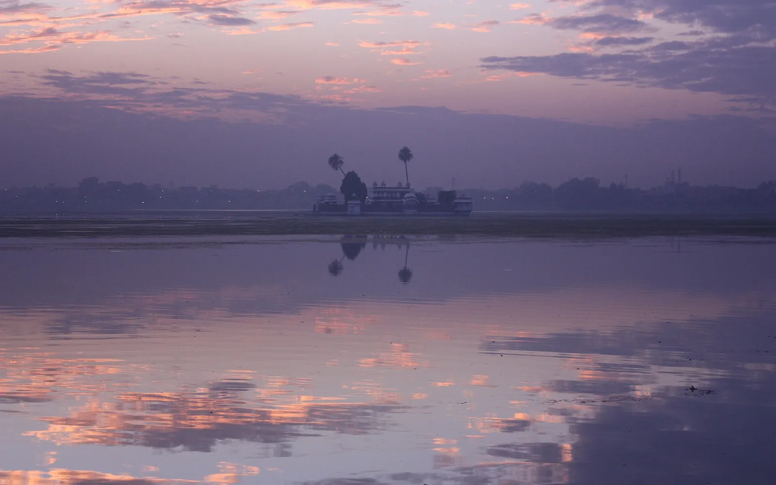
About 7 km from Rawatbhata, Bhainsrorgarh stands on a cliff where the Bamani joins the Chambal. It was granted in 1741 by Maharana Jagat Singh II of Mewar to Rawat Lal Singh of the Chundawat clan, so it is a Mewar fort rather than a Kota one. The present fort dates largely from the 1740s and is now a heritage hotel run by the family, so access inside is for guests; the view of the fort from the road and bridge is open to everyone. Read Bhainsrorgarh fort.
Bhainsrorgarh Wildlife Sanctuary
The forest around the fort is protected as a sanctuary of about 229 km2. Wikipedia lists dhok and khair as the main trees and leopard, chinkara, sambar, chital, four-horned antelope and wild boar among its animals, with migratory birds in season. There is no organised safari system like Ranthambore’s, so treat it as scenery on the drive rather than a wildlife outing. For safaris, see the safaris and wildlife hub.
Parajhar waterfall
A monsoon waterfall near Parajhar village with a cave shrine of Shiva, where a fair is held on Mahashivratri. Wikipedia notes that people have died in accidents near the fall, so go only in daylight and keep away from the water when it is high.
Older history around Rawatbhata
The power station and dams make Rawatbhata look like a modern town, but the land around it is old. Wikipedia notes that the Bhainsrorgarh area has been inhabited since at least the 2nd century BC, and the fort’s name is traditionally explained as a joining of the names of two traders, Bhainsa Sah and Rora Charan, who are said to have built an early stronghold to protect their caravans. The fort later passed through several clans before Mewar granted it to the Chundawats. Early British visitors also recorded fine sculpture in the area, including a reclining Vishnu that one archaeologist praised highly; many such pieces have since gone to museums. Kota’s Government Museum is a good place to see sculpture from the region.
On the way from Kota
The Rawatbhata road passes two of Kota’s best natural viewpoints. Garadia Mahadev looks down on a deep bend of the Chambal gorge, and Geparnath has a temple and monsoon waterfall at the bottom of a gorge. You also pass close to Jawahar Sagar dam, the third dam in the Chambal series, about 29 km upstream of Kota and 26 km below Rana Pratap Sagar. It was completed in 1972.
A one-day Rawatbhata plan from Kota
| Time | Stop | Notes |
|---|---|---|
| 8:00 | Leave Kota | Hired car or own vehicle |
| 9:00 | Garadia Mahadev (optional) | Short detour for the gorge view |
| 10:00 | Baroli temples | Allow 1 to 1.5 hours |
| 12:00 | Rana Pratap Sagar dam and Vikram Nagar | Lunch in Rawatbhata town |
| 14:00 | Chuliya Falls | Check whether gates are open |
| 15:30 | Bhainsrorgarh | Views of the fort and river confluence |
| 17:30 | Back in Kota | Avoid driving forest roads after dark |
Times are a guide only. Buses run from Kota to Rawatbhata, but the sights are spread out, so a car is far more practical.
About the atomic power station
The Rajasthan Atomic Power Station (RAPS) is one of India’s largest nuclear power plants. Unit 1 started in 1973 and was permanently shut down in 2004; later units followed from 1981 onwards, and a new 700 MW unit entered commercial operation in 2025, with another under construction. It is an operating, secure installation run by NPCIL. Do not try to enter, photograph the plant or fly drones near it, and follow any signs or instructions from security staff.
When to go
October to March is the most comfortable time for the temples and the drive. Late July to September is best for Chuliya and Parajhar, but check whether roads and approaches are open. Summer is very hot; start early and finish by midday. Our guide to the best time to visit Kota has more detail.
Combine Rawatbhata with
Rawatbhata pairs well with a day on the river in Kota, such as the Chambal river safari, or with a longer loop through the region’s hidden gems. For more forts in the region, see our guide to forts near Kota.
Frequently asked questions
How far is Rawatbhata from Kota?
About 50 km in a straight line and roughly 55 to 60 km by road, depending on the route. The drive usually takes around an hour and a half. Wikipedia gives 50 km from Kota; our Rana Pratap Sagar page uses about 59 km by road.
What is Rawatbhata famous for?
For the Rajasthan Atomic Power Station, which is why it is often called Rajasthan's nuclear city, and for the Rana Pratap Sagar dam on the Chambal. For visitors, the Baroli temple group, Chuliya Falls and Bhainsrorgarh fort are the real highlights.
Can tourists visit the Rawatbhata nuclear power plant?
Treat it as off limits. It is an operating power station and a secure installation, so do not try to enter, fly drones or photograph the plant area. Any visit would have to be arranged officially through the operator, NPCIL.
Is Rawatbhata worth a day trip from Kota?
Yes, if you like old temples and river scenery. The Baroli temples are among the finest early medieval temples in the region, and the Chambal gorge at Chuliya and Bhainsrorgarh is dramatic, especially after the monsoon.
Which district is Rawatbhata in?
Chittorgarh district, in the Udaipur division, even though it is much closer to Kota than to Chittorgarh city, which is about 131 km away.
Sources
Editorial team
The KotaRajasthan.net team writes about the places, history and festivals of Kota and Hadoti, and corrects pages when readers point out changes.